Urchin Colony Mapping Using AI
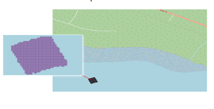
A collaboration with Canada's Department of Fisheries and Oceans to test the use of innovative AI technologies to enumerate green urchins in the Godbout area of the North Shore of the Saint-Lawrence River.
Partner
Industry
- Benthic Sciences
Scientists
- Yanick Gendreau (DFO)
- Filippo Ferrario (DFO)
Year
- 2022,2023,2024
Study Area
The Godbout area, located in Quebec, Canada, is of significant biological interest due to its diverse ecosystems and unique flora and fauna. The area's pristine natural habitats provide important breeding grounds for birds, serve as a crucial corridor for wildlife migration, and support diverse aquatic ecosystems in its rivers and coastal waters. The Godbout area is also a key site for studying the impacts of climate change on northern ecosystems.
Key Statistics
- 831 orthomosaics from scuba divers
- 6.858m² per zone
- 5699m² in total
Leveraging AI Tools
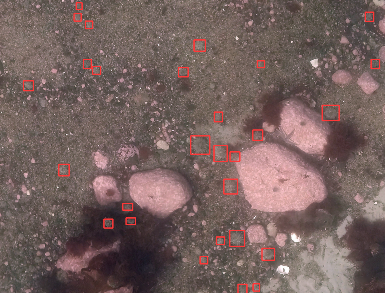
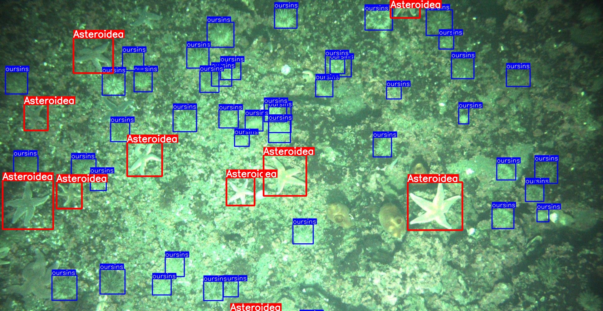
Once trained, the AI can detect urchins faster than the human eye and alleviate issues due to contrast, illumination and turbidity.
Total Running Time
- Under 3 minutes
- 5668 urchins detected
Spatial Distribution
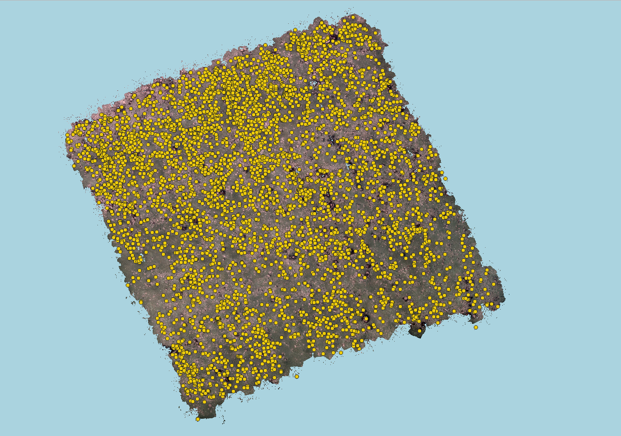
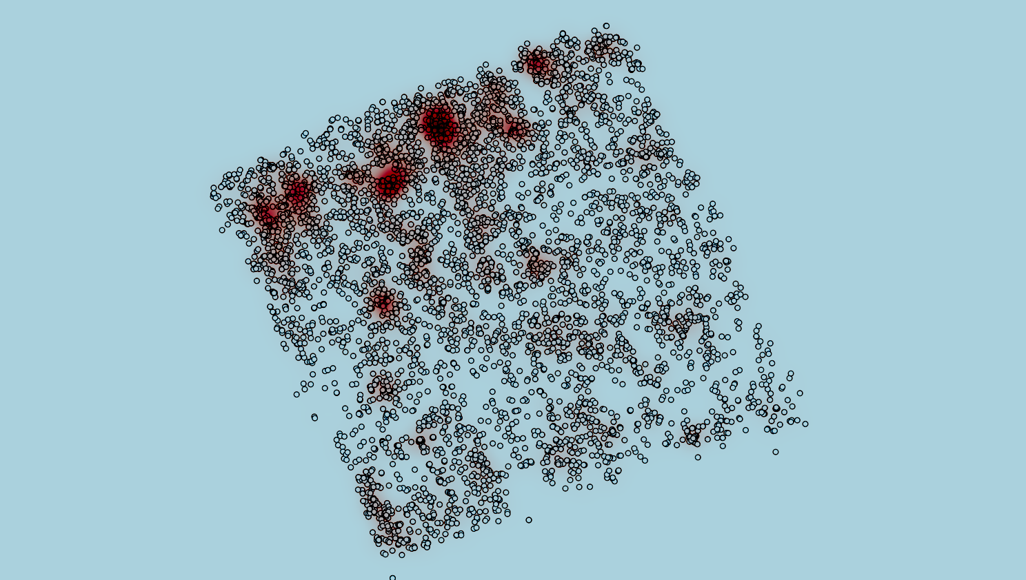
The spatial distribution of detected urchins’ positions and sizes can be readily exported as a SHP file for further analysis. Each dot represents an urchin over the seafloor’s orthomosaic.
These standardized data products can be imported into GIS software for further analysis.
Orthomosaic by Filippo Ferrario (DFO)
Specimen Size
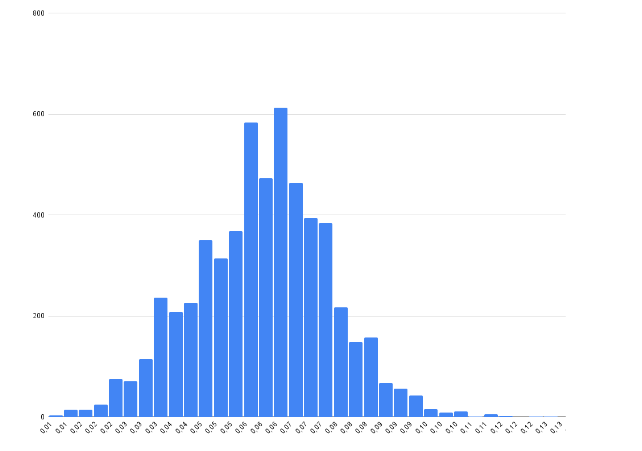
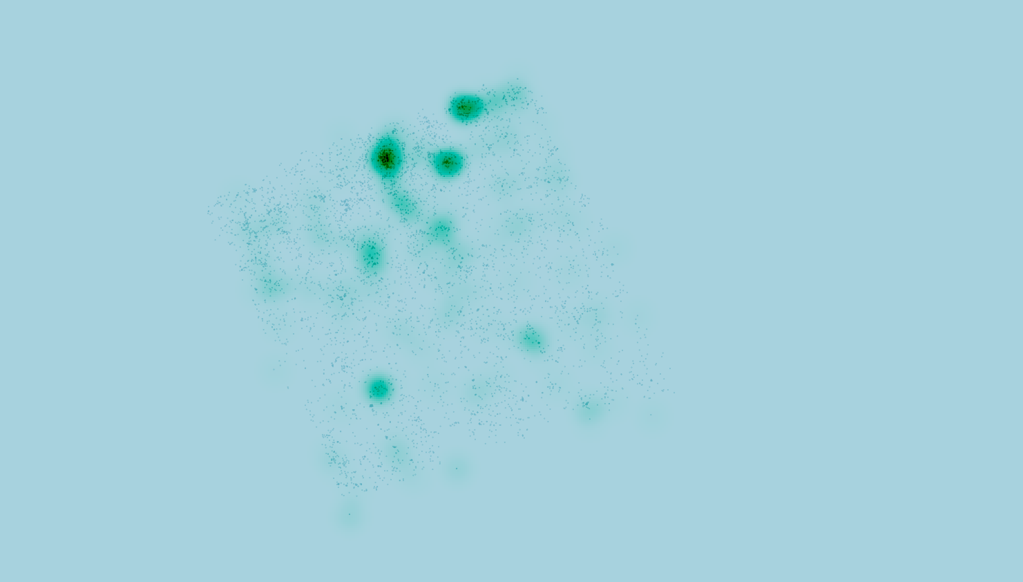
The AI can estimate specimen size and generate value-added data for the area of study. According to DFO guidelines, only specimens over 50mm are commercially viable.
Identifying commercially viable specimens
The algorithms yields significant value by quickly identifying commercially viable specimens automatically and extracting their distribution patterns.
This allows for drastic efficiency improvements by reducing the area to prospect specimens over 50mm.
Identifying key recruitment zones for sustainability
Identifying key recruitment areas ensures that young specimens are spared and that marine resource exploitation is compatible with sustainable development objectives.
Juvenile specimens under 30mm can be readily identified by the algorithms.
Maximizing profit while minimizing damage to the environment
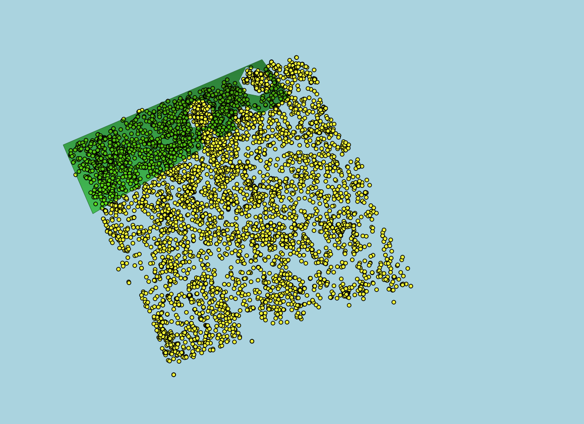
Using the informations from our model, we can determine an optimal exploitation zone that directly targets commercially viable specimens while systematically avoiding immature urchins.
Results
Automating the analysis of orthomosaics acquired by scuba divers has yielded game-changing time savings. Furthermore, streamlining the data value chain chain with custom GIS tools yields game-changing insights into marine resource management possibilities.
Area before optimization
Area after optimization
cost savings and less seafloor destruction
Do you want actionable insights fast? Contact us!


